Pets Allowed

First Peoples Buffalo Jump State Park

First Peoples Buffalo Jump State Park

First Peoples Buffalo Jump State Park

Located South of Great Falls and just outside of Ulm, First Peoples Buffalo Jump is one of the largest buffalo jumps in the United States and is known in the archeology community as the most significant buffalo jump in the world! Evidence suggests that this site, also known as the Ulm Pishkin, may have been the most frequently used buffalo jump in the world.

First Peoples Buffalo Jump State Park
IMG_5966

Download Park Map

Park history

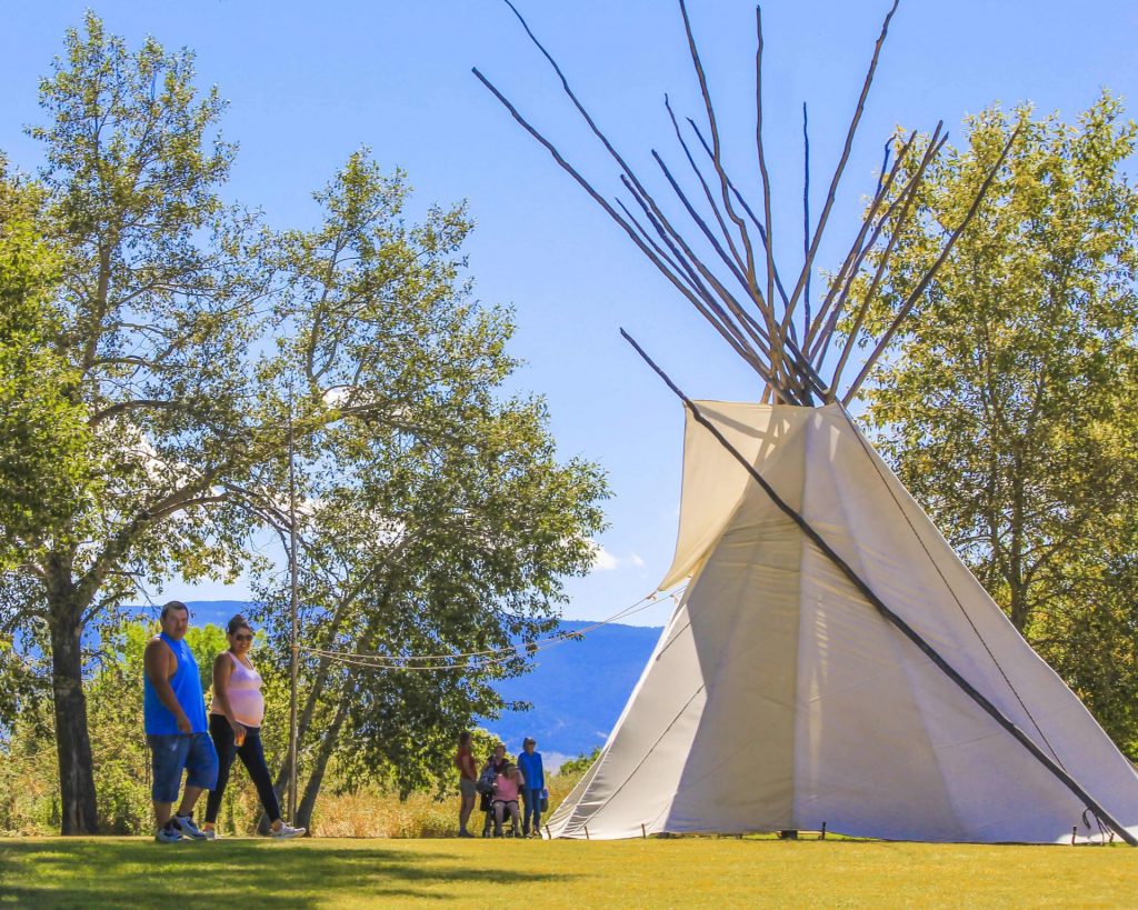
A 6,000 square foot Visitor Center helps to pay homage to both the buffalo and the Native American’s who honor it. Inside you’ll find buffalo culture exhibits, a circle for storytelling, a classroom, a gallery, and a bookstore!

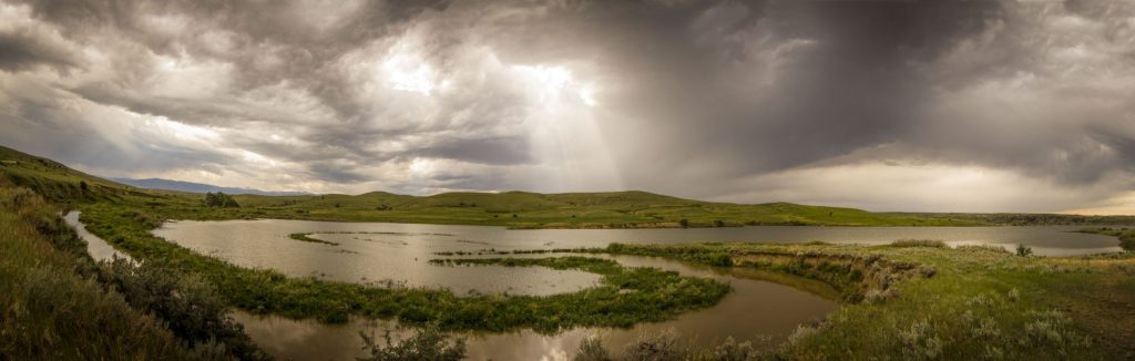
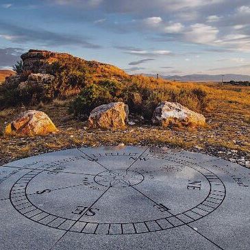
Outside the Visitor Center are an outdoor amphitheater and even a few traditional games playing fields. The cliffsides now offer up amazing views to visitors from all over the world.

At the base of the cliff, you can see 18 feet of compact buffalo remains, but it can be difficult to make out distinct items like skulls or other bones after so many years. The original name of the park “Ulm Pishkin” comes from the Blackfeet word "Pis'kun," meaning "deep kettle of blood”. The mile-long cliff ranges from 30 to 50 feet in height, any higher and meat may have been damaged and unusable. Of the over 300 buffalo kill sites in Montana, First Peoples Buffalo Jump is one of only three that are protected.

Native tribes would stampede herds of bison off the cliff and collect the remains below. Bison meat served as a main staple in the early Native American diets of the region. While this form of hunting was very popular and safe compared to the alternatives it was not the most common.

Ambush killing, where the hunters would sneak up to the animal before attacking, was the most frequent way for them to provide food, tools, and clothing to their families. It was very dangerous due to the size and strength of the animal. Because of this many of these sites are considered sacred. Ambush hunting became less and less utilized as the horse came onto the scene, allowing hunters to keep pace with the bison and guide them more effectively to sites like this and eventually as they began breeding horses even the buffalo jump became obsolete. Giving way to mounted hunters who could chase, kill, and carry back the precious remains.

The most accepted theory as to the use of “Buffalo Jumps” has the hunters slowly encircling the herds and pushing them towards the area. It could take hours if not days and was very dangerous.

As the herds would draw closer and closer to the cliffs they would be guided to a specific spot by others using low fences made of twisted vines and large rocks. These “Drive Lines” can still be found today. They sometimes extended over a quarter of a mile away.

Once the Buffalo had reached their holding spot the hunters would approach, sometimes wearing wolf pelts and sneaking on all fours, and when the time was right they would jump up shouting and making loud noises creating a stampede.

The fastest and bravest of the hunters, called “Buffalo-Runners” would dance in front of the herds leading them over the cliff. Often jumping to a safe spot just below the ledge.

After the herd had gone over or dispersed the women, children, and elders would move through the aftermath killing any that may have survived and then processing and harvesting as much of the animal as possible.

Plan to spend at least two hours at First Peoples Buffalo Jump to make time for the many activities!

*Notice!: Due to recent world-wide events Visitors Centers, Regional Offices, Ranger Stations, Campgrounds, and other facilities including many restrooms are now closed to the public. MT FWP is monitoring the situation and making changes to their policy on a rolling two week basis.

Years after the area was settled it became a cattle ranch and eventually mining area. Eventually, in the 1950s the bone itself began to be mined before a local rancher named Earl Monroe leased the land to protect it from further destruction.

Earl kept the land off-limits to the public while under his care. The land went through many hands and many legal battles over the years before finally coming under the protection of the state in the late ‘90s and becoming a full-fledged state park in the year 2000.


Did You Know

Curious what other visitors have had to say about the park?

"The museum itself was extremely neat and clean. It's a small establishment that you can tour yourself - which I LOVED! The 2 guides were helpful and answered any questions that we had regarding the jump. I would absolutely suggest this place to anyone visiting the Great Falls area."

"What a piece of history we knew nothing about. Fascinating and then taking the drive to the cliffs I couldn't imagine running ahead of a herd of buffalo and at the last minute jumping over the edge to safety. This park is definitely worth a visit. Make the time."

"Great history and amazing views of the valley. A great 1 mile hike up to the buffalo jump cliff, or take the road around the other side of you don't want to hike it. Restroom is available in the visitors building and near the cliff."

"What a great place to see. It is so peaceful and tranquil. I enjoyed it so very much."


Quick Facts
  • pine icon

    Park

    Summer - open daily.
    Winter - open Wednesday through Sunday.

  • pine icon

    Summer Hours 

    April 12 - September 12: open 8 am - 6 pm daily.

  • pine icon

    Winter Hours

    Sept. 14 to March 31:
    10 am - 4 pm Wed - Sat and 12 pm - 4 pm Sun.
    Closed Monday and Tuesday.
    The gates at the top of the Jump may be closed during times of deep snow.

  • pine icon

    Location

    342 Ulm -Vaughn Rd. Ulm, MT 59485

First Peoples Buffalo Jump State Park Read More »

Finley Point State Park 1

Finley Point State Park

Finley Point State Park

Finley Point State Park

Located on a narrow point on the south side of Flathead Lake, Finley Point is an ideal park for boaters and RV campers.

Finley Point is one of Montana's oldest state parks and has been open to the public since July 12th, 1965. The park is known as an excellent fishing location for Lake Trout and Kokanee Salmon. Anglers should note that state and tribal fishing licenses are required for fishing in the area.

Finley Point State Park
IMG_5965

Download Campsite Map

Looking to boat?

Boaters can rent a slip in the marina, some of which offer electric and water hookups for those camping on their boats. Along with the camping slips, the marina also offers 12 boat slips without electricity.

Camping, boating, and other visitor facilities at Finley Point State Park were recently rebuilt or expanded by WGM Group of Missoula, MT.

The new park layout and expanded facilities allow for more visitors to enjoy the park without feeling crowded and reducing impacts on sensitive lakeshore habitat.

Thinking of camping? Finley Point offers 18 RV campsites, seven tent sites and four boat camping slips. Maximum RV length will vary by campsite, so be sure to check out the ReserveAmerica website for additional details. 

MT State Parks Rangers frequently host interpretive storytelling and other special events at the park.  These programs usually take place in the evening and are free to registered campers at the park.  

While in close proximity to Polson and very busy during the summer months, Finley Point’s mature conifer forest helps the campground feel secluded. 

Did You Know

Curious what other visitors have had to say about the park?

"One simple word “AMAZING!” We love Finely Point!!"

"Beautiful scenic area, even if it's for a quick stop on your road trip. There was also an amazing massive field of pinkish flowers just on the north end of it when we were there!"

"The site was amazing!! It had amazing views right on the shore."

"Nice sites and many close to the water. Trees, nice base for tents. Dogs ok"


Quick Facts
  • pine icon

    Park

    Open April through October

  • pine icon

    Campground

    Open April through October

  • Tree icon

    Dock

    Contact park for availability.
    Dock is unusable when lake level is low. Typically lake level is high enough mid-June through early-September.

    For waves & wind forecast, check NOAA Graphical Flathead Lake Forecast

  • pine icon

    Location

    31453 S. Finley Point Rd. Finley Pt., MT 59806

Finley Point State Park Read More »

Council Grove State Park 6

Council Grove State Park

Council Grove State Park

Council Grove State Park

Council Grove State Park marks the site of the 1855 council between Superintendent of Indian Affairs and Territorial Governor of Washington, Isaac Stevens and members of the Flathead, Kootenai, and Pend d'Oreille Nations.

Council Grove State Park
IMG_5966

Download Park Map

The park is designated as a primitive park meaning that further development is prohibited. There is no visitor center, camping or staff at this location.

Vehicle size is limited to passenger vehicles.

It was at this site that Chief Victor of the Bitterroot Salish eventually marked an "X" on the treaty documents prepared by Stevens and his contingent. The Bitterroot Salish and their leader believed that they would not be required to leave the Bitterroot Valley as a result of the treaty signed at the 1855 Council. It would be 15 years before agents from the US government came to enforce provisions of the treaty requiring the Bitterroot Salish to relocate to the Mission Valley.

The area is now a quiet, serene state park. It is large enough at 187 acres for a nice walk or to find a quiet place next to the river for a picnic. The park is limited to day-use only activities with a handful of on-site amenities including vault toilets, picnic tables, drinking water, hiking trails, and ADA accessible facilities.

This park contains large, old-growth ponderosa pines, grassy meadows by the park picnic area, and large cottonwoods along the Clark Fork. There's also an aspen grove fed by a vernal pool (a shallow depression in clay-like soil that fills with water seasonally) and make great breeding habitat for frogs and salamanders.

The Hellgate Treaty between the United States government and the Salish, Kootenai and Pend d’Oreille Native Americans which created the Flathead Reservation was signed here on July 16, 1855. A monument in the park marks the location where the treaty was signed. 

Council Grove allows you to experience a feeling of solitude amongst the large, old-growth ponderosa pines, grassy fields, and cottonwood trees along the Clark Fork River. Many people come to the park for biking and hiking and even as a great place to fish, swim, and hunt in the right season. 

Did You Know

Curious what other visitors have had to say about the park?

"Beautiful park & very family friendly! Dogs are also aloud on leash. There is room for everyone to enjoy on the rocky/beachy area. Must check out if visiting Missoula Montana."

"Nice place for an easy stroll along the Clark Fork amongst the ponderosa pine."

"Clean and quiet. Nice to walk with my dogs."

"Good birdwatching; I osprey, hummingbirds, owls, occasionally see hawks and eagles."


Quick Facts
  • pine icon

    Park

    Day use only. No camping.
    Open daily all year
    Daylight hours

  • pine icon

    Location

    11249 Mullan Road
    Missoula, MT 59808

Council Grove State Park Read More »

Cooney State Park

Cooney State Park

Cooney State Park

Head to Cooney State Park, a reservoir 40 minutes south of Billings, to go boating, play in the water, camp, and fish. This is the most popular recreation area serving south-central Montana, and it's always a busy place in the summer!

We are able to bring you valuable information about this amazing state park thanks to the support of:

Visit Billings
Yellowstone Country Logo
Cooney State Park
IMG_5965

Download Campsite Map

IMG_5966

Download Park Map

Looking to fish?

Cooney has been a state park since October of 1970, and new visitor amenities have been added slowly over time. The 97 ft tall earthen dam on Red Lodge Creek that forms the reservoir was constructed in 1937 as part of a larger irrigation project for nearby farmers and ranchers.

Not only does the park have a gorgeous reservoir, but it has great views of the Beartooth Mountain Range in the background.

Regardless of the season, you’ll find excellent fishing for walleye and rainbow trout. And don’t forget, the Red Lodge Arm has a fish cleaning station!

Planning to bring your boat along? You shouldn’t have any issues finding a place to drop in with three boat docks and ramps surrounding the lake!

During the winter, some people enjoy kite-skiing across the lake! 

Camping is plentiful at Cooney State Park, with five campgrounds and 82 campsites, 19 of which have electricity! While the electricity in the campgrounds is on year-round, be aware the water is shut off during the winter months. 

There are also three day-use group areas available around the lake. 

Did You Know

Curious what other visitors have had to say about the park?

"Moon coming out on a beautiful night on Cooney, fireworks northeast, south Red Lodge mountain still snow on the runs, people laughing in the distance having fun, winds died so this sailboat not going anywhere, on the hook south of Red lodge camping area wow it really doesn't get any better than this!"

"Park Ranger and the camp host were both really great with answering all our questions and giving directions to camp and nearest local convenience store! The campground is clean and beautiful, right on the lake, but not much shade so come prepared!"

"Every day of fishing is a good day. Mostly with scenery like this."

"It's an awesome place! Boat ramps, fishing, boating swimming, fires and camping! And you can rent kayaks and paddle boards."


"Just a little piece of heaven."

Quick Facts
  • pine icon

    Park

    Open Year-Round

  • pine icon

    Electricity

    Available

  • pine icon

    Drinking Water

    Available May 15 - September 27.

  • pine icon

    Comfort Stations & Showers

    Flush toilets available May 15 - September 27.

    Metered showers available to all registered campers in Marshall Cove Campground.  Requires 8 quarters for each shower.

  • pine icon

    Docks

    Available May 1 - November 1, weather dependent

  • pine icon

    Location

    86 Lake Shore Road

    Roberts, MT 59070

Cooney State Park Read More »

Clark's Lookout State Park 4

Clark’s Lookout State Park

Clark's Lookout State Park

Clark’s Lookout State Park

Clark's Lookout State Park is located one mile north of Dillon, above the Beaverhead River.

Established December 23, 1985, Clark's Lookout is set along the historic Lewis and Clark trail.

Clark's Lookout State Park
IMG_5966

Download Park Map

Looking to camp?

On August 13, 1805, Lewis & Clark and the Corps of Discovery found what is now Clark’s Lookout State Park. Having traveled from the headwaters of the Missouri River and up the Jefferson River to continue their search for a passage to the Pacific Ocean, they found an incredible view instead.

The view from the top of the hill provided Lewis & Clark and the Corps of Discovery with a view of what lay ahead. And William Clark worked to explore and document the hill overlooking the Beaverhead River.

  • Take a walk to the monument and gaze out over the land once surveyed by William Clark.
  • Have a picnic at the perfectly located picnic area.
  • Take a hike through the rest of the 7.23 acres via hiking trails with interpretive signs.
  • Cultural and Heritage information is provided on-site.
  • Check out all of the local wildlife, including bird watching.
  • Photographic opportunities abound.
  • Plus so many more!

Interpretive signs help to explain the navigational methods used by the Corps of Discovery.

A short hike to the top of the lookout provides an incredible view of the Beaverhead Valley.

You’ll also find a granite monument shaped like a compass which displays the three compass readings Clark took in 1805! The compass monument’s design came from a small pocket compass Clark carried during the expedition!

Did You Know

Curious what other visitors have had to say about the park?

"Fun! I love history. Didn't know this was there until we drove by."

"Great place to stop for a walk and see a historic sight."

"Picturesque views."

"Nice place to stop for a short walk up a path to some beautiful views."


Quick Facts
  • pine icon

    Park

    Open:  May 1 - September 30

    Hours:  8:00 a.m. - Sunset

  • pine icon

    Location

    25 Clark’s Lookout Road
    Dillon, MT 59725 Park

Parks That Others Are Visiting

Clark’s Lookout State Park Read More »

Chief Plenty Coups State Park

Chief Plenty Coups State Park

Chief Plenty Coups State Park

Chief Plenty Coups State Park is named for the last traditional chief of the Crow Nation, Chief Plenty Coups (Aleek-chea-ahoosh, meaning "many achievements"). Plenty Coups was a man of war - and then a man of peace - whose vision has helped bridge a gap between two cultures.

Recognized for his bravery and leadership, he was made chief of the Apsáalooke (Crow) tribe by age 28. 

We are able to bring you valuable information about this amazing state park thanks to the support of:

Chief Plenty Coups State Park
IMG_5966

Download Park Map

Looking to camp?

On his land, Chief Plenty Coups built a log home, began farming, and eventually opened a general store.

You won’t find camping at Chief Plenty Coups State Park, but you will find a day’s worth of activities!

  • Hike the ¾ mile trail around the grounds and near the creek.
  • Take in the beauty and serenity while enjoying lunch in the picnic area.
  • Bird watching.
  • Learn more about Chief Plenty Coups’ life and Native American culture at the visitor center.
  • Have a fishing license? Try and catch a fish in the creek!

While traveling to Washington D.C., Plenty Coups toured George Washington's estate, Mount Vernon, and was struck by the idea of a national monument open to all.

In 1932, at age 84, Chief Plenty Coups passed away and at his and his wife, Strikes the Iron’s, request, a portion of their homestead was made into a state park which eventually grew to 195 acres for all people to visit and learn from and still operates as such today!

At the burial of the unknown soldier at Arlington Cemetery in 1921, Chief Plenty Coups attended as a representative of all the Indian Nations. While the ceremony commenced, Chief Plenty Coups placed his headdress and two coups sticks on the tomb in honor of the fallen soldiers.

The headdress and coups sticks can still be seen today on display in the Virginia cemetery. Chief Plenty Coups was a well-known statesman and ambassador, he knew several U.S. Presidents and met many foreign leaders during his life. 

Chief Plenty Coups is remembered for helping to bridge the divide between Native American people and white settlers during a time when the Native American people were being coerced into giving up their traditional ways. 

Through the Indian Allotment Act, Chief Plenty Coups received an allotment of land which included a sacred spring, something that Plenty Coups envisioned as a young man, and became one of the first Apsáalooke to own and settle on a farm.

Did You Know

Curious what other visitors have had to say about the park?

"We stopped to eat lunch here. Peaceful place to be. Well taken care of and a lot of pride goes into it."

"Helpful and friendly rangers. Nice historic buildings. Good walking. Beautiful surroundings. Natural spring."

"Friendly museum worker and very informative info about the Chief and his tribe. Nice and easy scenic walk around the grounds."

"It was our first time here and it was truly an emotional experience. So much history to read and the photo books to look through were amazing!! Definitely recommend!"


Quick Facts
  • pine icon

    Park

    Day Use Only. No Camping.

    Summer Hours

    mid-May – mid-September

    Open daily 8 am - 8 pm

    Winter Hours

    Wed-Sunday 8:00am to 5:00pm

    Closed Monday and Tuesday

  • pine icon

    Visitor Center & Chief’s House

    10 am - 5 pm.

    Closed all federal and state holidays except Memorial Day, Fourth of July, and Labor Day. Park is also closed December 24th and 31st.

  • pine icon

    Location

    1 Edgar/Pryor Road

    Pryor, MT 59066

Parks That Others Are Visiting

Chief Plenty Coups State Park Read More »

Brush Lake State Park

Brush Lake State Park

Brush Lake State Park

Brush Lake State Park

Brush Lake State Park is the only state park in the northeast corner of Montana.

Brush Lake is a deep lake (65 feet) in a closed basin and the site of National Science Foundation research on climate change. The lake boasts 45 feet of sediments showcasing 10,000 years of pollen and mineral depositing helping to tell the story of climate, and its changes, since the Ice Age.

Brush Lake State Park
IMG_5965

Download Campsite Map

IMG_5966

Download Park Map

Looking to camp?

Brush Lake State Park is 280-acres and its water quality is theorized to be more ocean-like than freshwater like - making it an ideal swimming location in the summer months. Both deep and incredibly clear, Brush Lake’s beaches are surrounded by grass fields and spring wheat during the summer.

  • Hoping to camp? You can do so in one of the 12 campsites!
  • Take a hike and go bird watching along the shore.
  • Public swimming access is on the northeast part of the lake where the day-use area is also located.
  • Utilize the boat launch and take your boat, canoe or kayak out for a day on the water.
  • Have a picnic on the beach!
  • Plus so much more!

Due to its close proximity to Canada, during Prohibition liquor was easy to come by and kept the Brush Lake Summer Resort in business. There was also a dance hall! After the Prohibition era, church and scout groups used the lake, but in the years before it became a state park, Brush Lake wasn’t the popular destination it once had been. Today the area where the dance hall once stood on the south side of the lake, is now privately held.

In Eastern Montana, it is not uncommon to see the Aurora Borealis during solar events, especially during the fall and winter. Brush Lake's northern latitude and remote location make it a "stellar" destination for your next stargazing or northern lights viewing adventure. As a dark sky location, Brush Lake is guaranteed to bring some of the best night sky views in the area.

Because of the high alkali content, Brush Lake does not support a significant fish population. But in contrast, it showcases a distinctive aquamarine blue color. The lake attracts many varieties of birds including various species of ducks, gulls, and many others. Brush Lake has become a great location for bird watchers worldwide.

Did You Know

Curious what other visitors have had to say about the park?

"Just on weekdays enjoy the beauty of this lake! I liked when you reach there no network service so really enjoy your time , clean water nice for swimming and have fun with kids."

"Lake was nice and clean."

Quick Facts
  • pine icon

    Park

    Open May 1 - January 1 depending on snowfall
    Day use hours: 7 am to 10 pm.

  • pine icon

    Campground

    Open May 1 - January 1 depending on snowfall

  • pine icon

    Potable water

    Yes - depending on the weather

  • pine icon

    Location

    1733 Brush Lake Road
    Dagmar, MT 59219

Brush Lake State Park Read More »

Black Sandy State Park 1

Black Sandy State Park

Black Sandy State Park

Black Sandy State Park

Black Sandy State Park is an extremely popular weekend boating, fishing, camping, and water skiing location.

You can make reservations up to one day in advance of your arrival date. For same-day availability, try the park office 406-458-3221 to check if any sites are available for that night. There are also boat slips for rent on a first-come, first-served basis.

Black Sandy State Park
IMG_5965

Download Campsite Map

IMG_5966

Download Park Map

Looking to camp?

Black Sandy State Park has 29 campsites with electricity that you can reserve, and 6 campsites without electricity that are first come-first served.
The maximum trailer length is 35 ft.

There is NO lifeguard on duty at Black Sandy State Park.

The dam that forms Hauser reservoir, was built in the early 1900s and named after former governor Samuel Thomas Hauser. The park lies along the Lewis and Clark National Historic Trail. The Lewis and Clark Expedition passed through the area in 1805.

Prior to 1980, Montana Power Company owned the land and operated the park as a recreation area. In 1980, Montana Power turned over management of the park to Montana Department of Fish, Wildlife and Parks (FWP). In 1982, it was designated a state recreation area. Later on, the land was also turned over to FWP. (via wiki)

Did You Know

Curious what other visitors have had to say about the park?

"Went overnight for tent camping. Nice spot right next to the water. There are 6 tent spots, none of which are bad. RV pads look nice right next to the water."

"Very nice areas, usually less crowded than Canyon Ferry. Make sure you stock up before you go, there aren't any stores close by. Some nice hikes and chances to see some wildlife."

"One of the most beautiful, peaceful places on earth. We only planned to stay one nite but extended for another nite because it was so peacefully and relaxing here."

"This is an excellent location for outdoor recreation. Plus, the staff are super friendly and the facilities are always maintained; very clean! "


"Close to helena, well kept but busy most of the time. All kinds of camping, close to a convenience store. State owned therefore inexpensive, and family friendly."

Quick Facts
  • pine icon

    Park

    Open 24 hours/day all year for day use and camping.

    May 1- Nov 30: electrical hookups available

    Dec 1 - May 1: Limited facilities available

  • pine icon

    Normal Hours

    Winter hours, October 7 - April 13: Open Wed - Sun, 10 am - 4 pm.
    Summer hours: 8:30 am - 4:30 pm daily; Open until 6:30pm in mid-summer.

  • pine icon

    Location

    6563 Hauser Dam Road
    Helena, MT 59602

Black Sandy State Park Read More »

Big Arm State Park

Big Arm State Park

Big Arm State Park

Big Arm State Park is located on the western shore of Flathead Lake and less than 20 minutes outside of Polson, MT.

Flathead is the largest natural freshwater lake in the western United States. Twenty-eight miles long and 15 miles wide, Flathead Lake is renowned for its beauty.


Big Arm State Park
IMG_5965

Download Campsite Map

IMG_5966

Download Park Map

Looking to camp?

The park has both flush and vault toilets, tent/RV sites, bear-resistant storage lockers, boat trailer parking, sheltered picnic tables, drinking water, grills/fire rings, firewood, picnic tables, trash cans, and coin-operated showers. RV/trailer size is limited to 30 feet in the 41 site campground. 

There are also seven tent-only campsites available. Big Arm has also added two yurts, including one that is entirely ADA accessible. Plans for more yurts, cabins and other accommodations are in the works. 

You will need a joint state/tribal for fishing license or fishing at this park, and campers may stay only 14 days during a 30-day period. Pets are required to be on leashes. Fees are charged for day use and camping.

  • Lounge on the long pebble beach or take a dip in the lake to cool off.
  • Come prepared with your joint state/tribal fishing license if you want to try and catch a big one!
  • Take a scenic hike on the trail, which provides outstanding views of the mountains.
  • Catch a glimpse of wildlife, including birds, deer, and even a bear from time to time
  • Spend a day on the lake boating, skiing or wakeboarding
  • Experience a feeling of tranquility while camping under a collection of mature ponderosa pine and juniper trees
  • Plus so many more!
  • Open April through October
  • Day-Use Area Open Year-Round
  • 217 acres
  • ADA Accessible 
  • Pets Allowed
  • Toilets (Vault & Flush)
  • Water
  • Yurt 
  • Firewood for Sale 
  • Picnic Shelter
  • Boat Launch

On Flathead Lake's Big Arm Bay, this park is a popular destination for camping, swimming, fishing, picnicking, and as a jump-off point to Wild Horse Island.

Big Arm's pebble beach is a popular place to get your feet wet or take a swim in the lake.

Mature pine and fir trees surround the campsites at the park. Other activities at the park include fishing for lake trout, boating, fishing, swimming, camping, picnicking, bicycling, hiking the park trails, wildlife viewing, scuba diving, and water-skiing.

The water in Ackley Lake comes from the Judith River and is stockpiled for irrigation use!

Did You Know

Curious what other visitors have had to say about the park?

"Wonderful camp grounds. Nice hosts, clean restrooms - overall well run and managed. It's a fantastic place to camp and play on the lake."

"Camped here with our boat. It was perfect! Great roomy sites and lots of shade. Yurt was very clean and bathrooms were better than most campsites we've been too."

"Big Arm campsite is super nice for fishing and swimming. Would 100% recommend it!"

"Beautiful place. Clear lake. Friendly people"


Quick Facts
  • pine icon

    Park

    Day use area open year-round

  • pine icon

    Campground

    Open April through October

  • pine icon

    Water

    Available mid-May through mid-September

  • pine icon

    Shower House & Flush Toilets

    Open mid-May through mid-September

  • pine icon

    Dock

    Normally available mid-March through November, weather permitting. 

  • pine icon

    Location

    28031 Big Arm State Park Road

    Big Arm, MT 59910

Parks That Others Are Visiting

Big Arm State Park Read More »

Beavertail Hill State Park 1

Beavertail Hill State Park

Beavertail Hill State Park

Beavertail Hill State Park

This park has a one-half mile of Clark Fork River frontage that provides fishing and floating opportunities. Boating is carry-in only. There are 24 developed campsites and 2 tipi rentals.

There is a walking nature trail through a thick canopy of cottonwood trees that takes about an hour from start to finish. The park has an elevation of 3,615 feet and is 65 acres. RV and trailer units have a limit size of 28 feet. 

Beavertail Hill State Park
IMG_5965

Download Campsite Map

IMG_5966

Download Park Map

Beavertail Hill is one of Montana's busiest state parks based on the number of nights people camped at the park.

During the summer, free interpretive programs are hosted in the amphitheater on Saturday evenings.

Park Rangers and other outdoor professionals use these programs to teach park visitors about the history, geography, geology, and other nature-based topics throughout the summer months.

Did You Know

Curious what other visitors have had to say about the park?

"First time staying here. Great little campground. Well maintained. Hosts were very pleasant and helpful. Will be staying here again in the future."

"Spent one night and enjoyed our stay. Sites were level and very large with tree-privacy. We spotted 17 bird species, elk and ground hogs."

"What a beautiful, secluded camp ground on the river! We just stopped in to have a picnic lunch. It is only a half mile from I-90, but it is so quiet!"

"Tipi rental was very clean, functioning and authentic. Dogs must be on a leash but there are fully functioning bathrooms and readily accessible potable water. Plenty of memories were made and we will definitely do this again."


"Nice quiet place to take a hike, or you can go camping or go fishing in the river."

Quick Facts
  • pine icon

    Park

    Summer Season
    Open 5/1 through 10/31
    24 hours/day
     
    Winter Season
    Nov 1 - April 30.
    Closed to all motorized traffic, walk-in only. Day-use only, no overnight camping.

  • pine icon

    Location

    29895 Bonita Station Road
    Clinton, MT 59825

Parks That Others Are Visiting

Beavertail Hill State Park Read More »

Skip to content